The signature figure
The Gradient
Read a whole ecology as a single climb — the gulf-to-range cross-section the book is built around, and the figure programme that maps every step of it.
The organising idea
One slope,
the whole argument
Drive from a metropolitan beach to the summit of Mount Lofty and down the other side, and in under an hour you cross the entire argument of this book.
Gulf St Vincent's seagrass meadows and samphire flats give way to the Adelaide Plains, then the range front, then the Mount Lofty summits, then the rain-shadow mallee behind — a single short, steep, lopsided climb that demonstrates, rather than merely tours, everything the book's first two acts set up. Salt and dry at the sea; wet and green at the top; dry again in the shadow behind the crest. Three things change together as you climb it — rainfall rising, temperature falling, and soil turning from alkaline plains clay to leached, acid hill soil — and the region's living communities sort themselves out along that one slope in the order a reader would walk them.
Figure 9 · the anchor
The whole book on one slope
The single image the book is built around: the Adelaide region sliced open from the floor of the gulf to the summit of Mount Lofty and down into the mallee, its habitat bands arranged along the cut face in the order a reader walks them, with rainfall, temperature and soil reference strips beneath making the "three things change together" argument explicit.
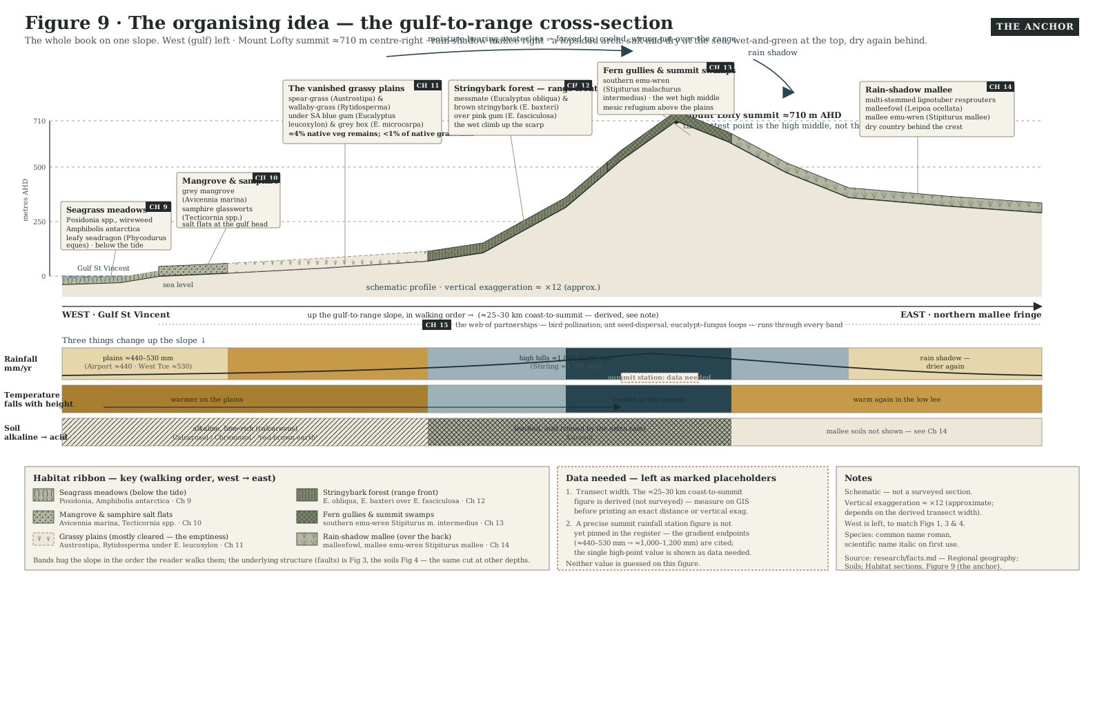
Vertical exaggeration; schematic, not to a surveyed scale. This is Chapter 8's figure, The organising idea — the framing chapter for the book's whole third act.
The figure programme
Every other figure, by act
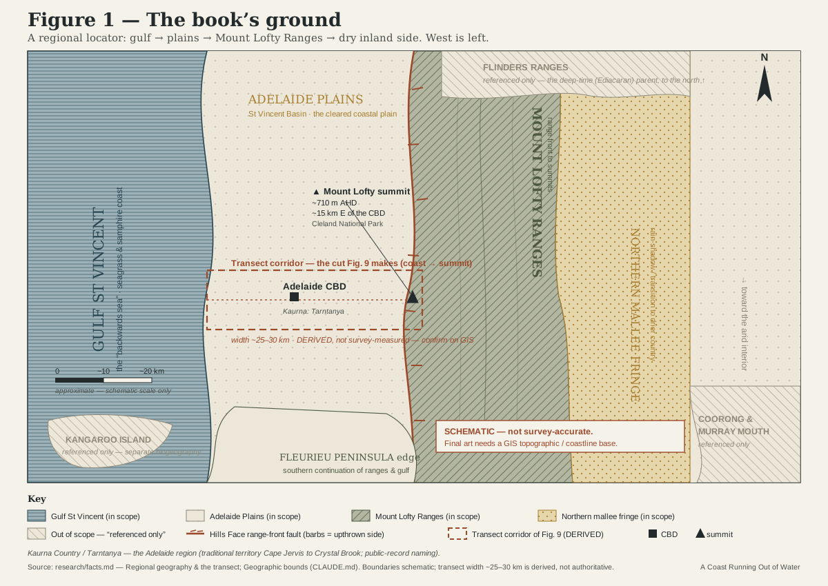
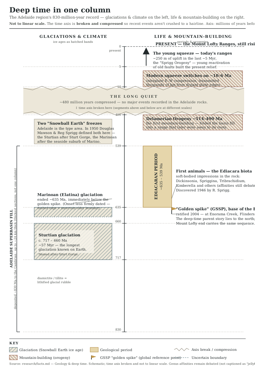
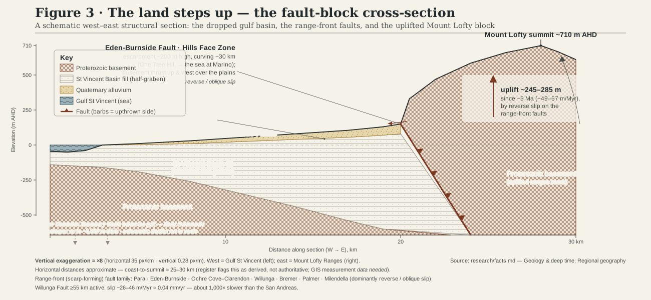
The book's figures share one visual language — west always on the left, blue for water, gold for drought, red-brown earth for rock and emphasis, sage for vegetation — and every one of them is subordinate to the cross-section above. Grouped here by the four acts of the causal braid, in the order the book builds its case.
Act I · deep time built the stage
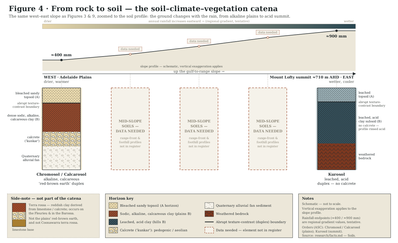
Rock, faults and the deep past
Act II · the drought engine sets the rules
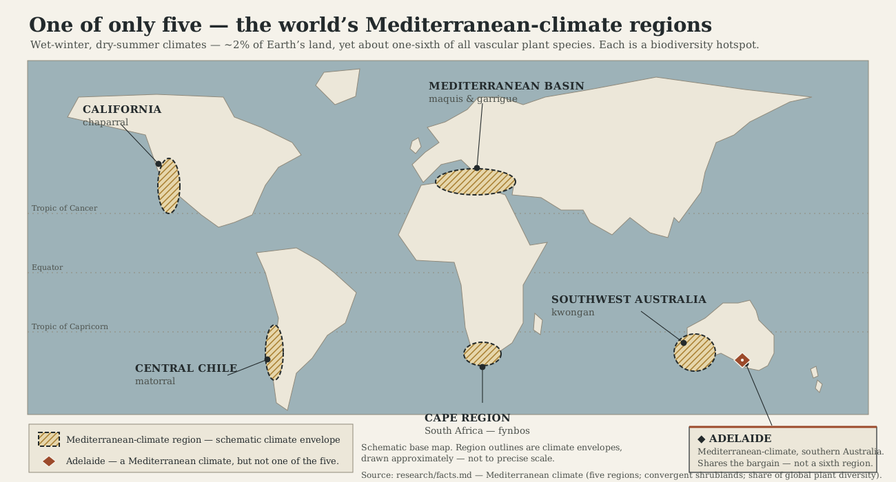
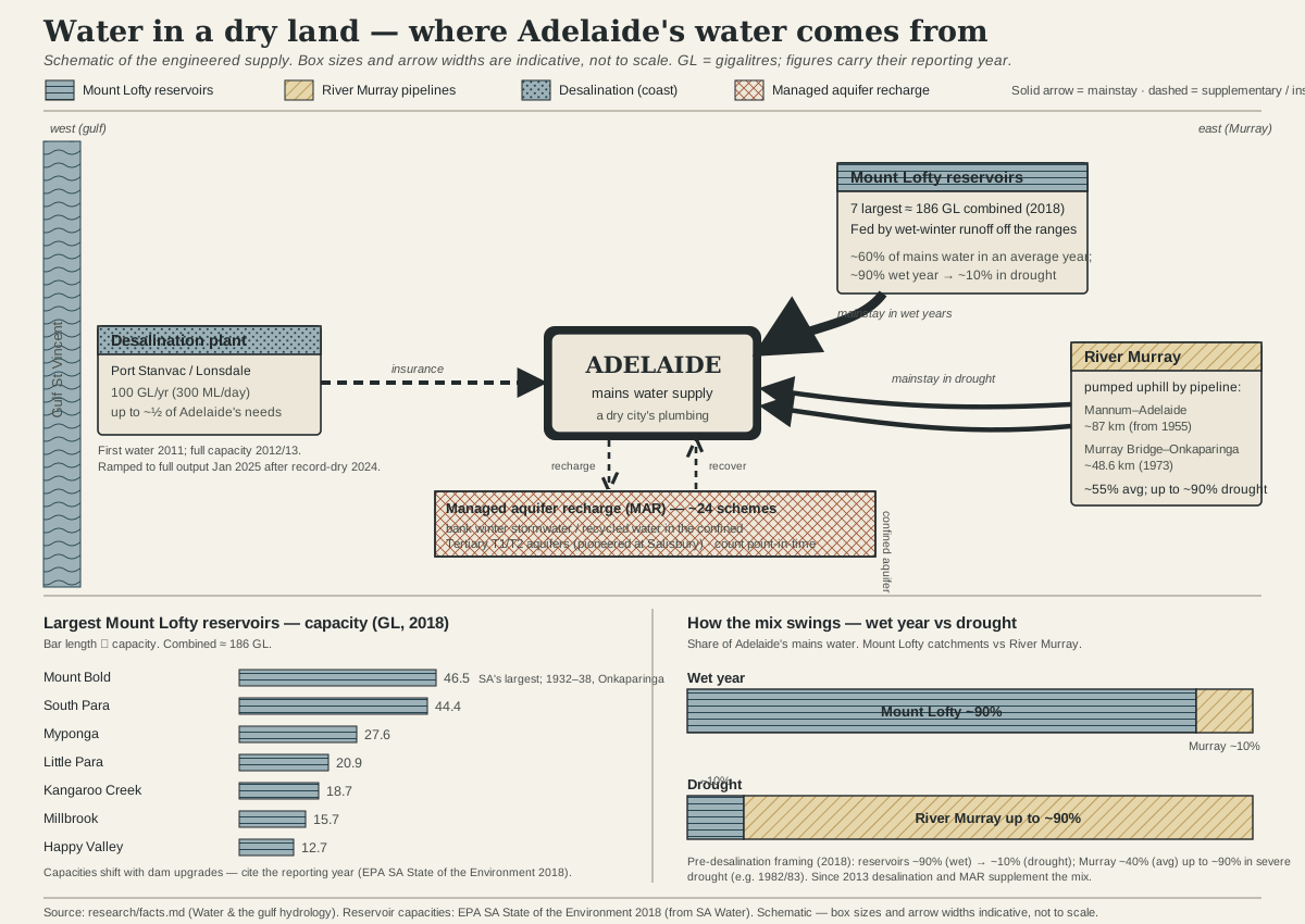
A globally rare bargain with the seasons
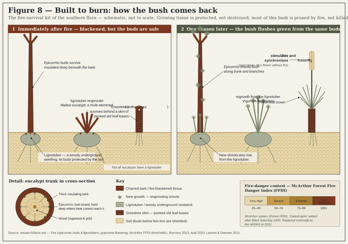
Act III · the living gradient demonstrates the rules
Beyond the anchor: two more slices of the slope
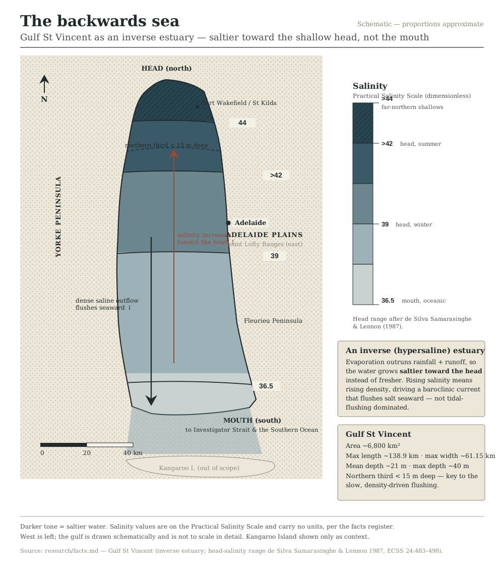
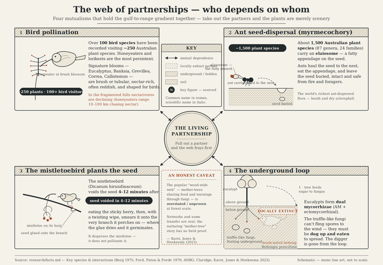
Act IV · the great clearing, and caring for Country
Reading absence, made visible
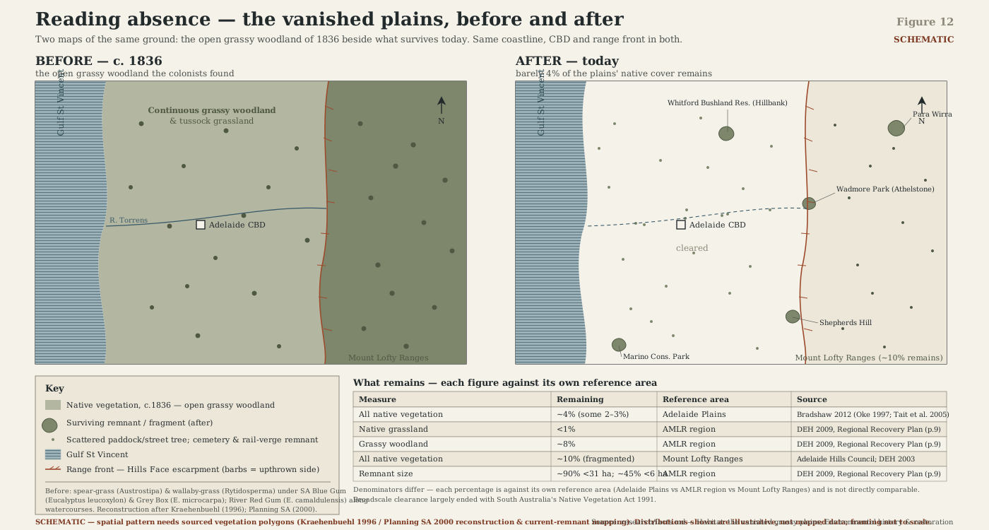
This is the book's "reading absence" thread at its most literal: not a lament, but a detective act.
A paddock, a street tree, a fence-line remnant is read for what it is the last trace of. The percentages behind this figure — roughly four per cent of the plains' native vegetation surviving, less than one per cent of its native grassland — carry different reference areas depending on the source, which is exactly the kind of figure this book's method insists on labelling carefully rather than rounding to a tidy headline.
Three figures in the programme are still to be drawn. Goyder's Line (the 1865 survey marking where reliable cropping rainfall ran out), the East Asian–Australasian Flyway map (tracing Gulf St Vincent's shorebirds to their Arctic breeding grounds), and the Mount Lofty rainfall island (the metro-scale view of the same wet-hills-dry-plains pattern the cross-section shows in profile). They will join this gallery once they exist.
Follow the writing
One email, when there's real news
No countdown, no sales pitch — just a note when a chapter reaches a real milestone, or when the book itself is ready to read.
Free. No spam. Unsubscribe any time.